After hiking through Glacier National Park, the Bob Marshall Wilderness, the Pintler Wilderness, Yellowstone National Park, the Wind River range and countless other breathtaking locations with epic vistas and natural wonders, many CDT hikers dread "the basin" in southern Wyoming. I had been hearing about it for hundreds of miles, with lots of fearmongering on the apps and Facebook groups. But what is the basin? Why so much dread??

The Continental Divide itself is a geographical line that separates the oceans- rain falling on either side of it eventually flows to one ocean or another, dividing the watersheds of the country. This part of the Red Desert in Wyoming, known as the Great Divide Basin, is special in that none of the water falling as rain to the ground drains into any ocean, directly or indirectly. Falling rain stays within the basin, and the Divide itself loops around each side through the surrounding mountains. The land within this loop is high desert full of sand dunes, bluffs and alkali flats. Though there are some shrubs that provide minimal shade, there are very few trees, and the land is dominated by sagebrush with wildflowers and prickly cacti mixed in. I saw pronghorns and deer, lots of birds, a wild horse, a few snakes and quite a few horny toads that skittered speedily underfoot.

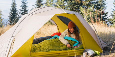
The basin stretches for approximately 200 trail miles, with the CDT following a tangle of dirt roads through this exposed ecosystem. The sunrises and sunsets are majestic and the storms can be spectacular. Hiking in the morning and evening is quite lovely but by 1pm, you start wanting to climb under a rock just to hide from the sun. There are 30 to 50 mile stretches between shade trees, and comments in logbooks and on our mapping app note things like "34 miles to next shade NOBO". The wind is intense throughout the day with nothing to block it, and finding a spot without rocks or sagebrush to put my tent each night where it also might not be ripped to shreds by the wind was a challenge.
The moon and stars are incredible, and some people night hike and cowboy camp (no tent!) through the basin. I enjoyed setting up camp in the light of the full moon and falling asleep to the sounds of coyotes yipping in the distance. Free range cows were everywhere and occasionally blocked my path and visited my campsites. The cows made water sources less than ideal, with many of the already sparse sources being contaminated with excrement and others just difficult to access due to torn up/muddy terrain or a bovine herd guarding their oasis.

For me, the Basin has provided an opportunity to make big miles and challenge myself. The terrain is relatively flat and the trail mostly follows dirt roads, allowing me to open my stride and really move. My last three days on trail have been my highest mileage yet, each day topping the one before, hitting 40.5 miles yesterday. It feels good to be able to really stretch my legs and push my body and mind in this way, and I am surprised by how much I have been able to do, despite the sand dunes occasionally making it feel like I am hiking on Tatooine.

Though the basin certainly doesn't have the spectacular rock spires of the Winds or the wildflower superblooms of the Pintlers, it does have its own unique beauty and charm. I was initially underwhelmed and didn't understand the geographical relevance of this area, but my mindset shifted once I understood why the trail comes through this section of high desert. I now appreciate the undrinkable saltwater ponds and seemingly infinite stretches of shadeless sagebrush, and am glad to have been able to push my body and find out what I am capable of. With just a few more days in the basin, I am glad for this new appreciation and also looking forward to returning to the mountains as I head into Colorado!
- Scribe


