The Continental Divide Trail generally follows the geographical Continental Divide, the boundary that separates the continent's river systems. Rain that falls to the east of the divide eventually goes to the Missouri River, and rain that falls to the west of the divide goes to the Pacific Ocean. The divide itself is generally high in the mountains, following sharp ridges and cresting high peaks.
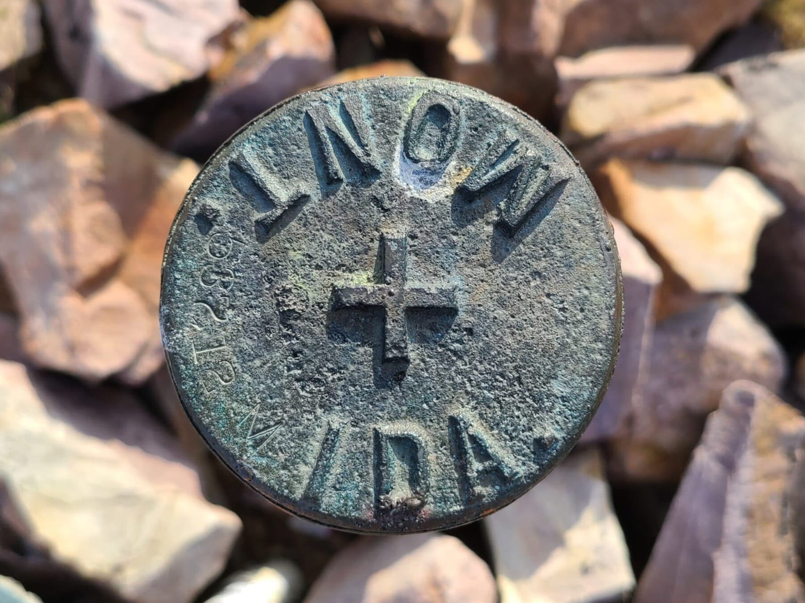
The trail sticks to this line relatively well, and the divide is also the geographical boundary between Montana and Idaho for many miles. This means that for hundreds of miles, I generally did not know what state I was in. We came to know this section as "Montandaho" and embraced the ambiguity. Sometimes the trail dropped into Montana, sometimes into Idaho, and truly it didn't really matter where we were (unless we were hitchhiking, which is illegal in Idaho), but that brought up a different feeling of naivete: do I actually know where I am?

Thru-hikers typically use phone apps to navigate the trail, and those apps provide fantastic data about where you are relative to the trail itself, but not much more than that. Usually it will provide road names and highway numbers, nearby towns and sometimes (depending on which maps you download) you can get the names of a a few mountains and other features. When I meet locals in town or weekenders on trail however, they always remind me of how little I know about where I am. They ask, "Did you see ___ River?" I don't know. "Where did you come from today? ___ Meadow?" Unsure. "Your trail goes through ____, right?" No idea. I'll get suggestions of places to see or towns to visit and they aren't on any of my maps, leaving me feeling a bit unsettled. I can use a map well, and have to bushwhack regularly so tend to feel pretty confident out there, but when the maps don't have much information, I still feel lost.

There is a fence along the Montana-Idaho border that is in various states of disrepair, but helps to navigate in places where the trail is not obvious, which is often. There were dozens of times when I would just have a feeling that I was off trail, open my app and confirm that yep, the trail is [waves arm to the side] over yonder somewhere, and I definitely am not on it. I could consistently find my way back to that disappearing line in the dirt, but had absolutely could not tell you what state I was in most days.

Montandaho was incredibly beautiful and the high ridge walks were some of the most brutal and breathtaking sections of trail thus far. This area taught me to think about navigation in a different way, and also helped humble me about "knowing" the area. Am I on trail? Yes. Do I know where I am other than that? Not exactly. Does it matter? I certainly hope not.
- Scribe